


The London Museum of Water & Steam will be hosting a talk by researcher and author James Douet on Thursday August 27 about the Victorian Sanitary Crisis. James will be drawing on the research for his 2024 book, ‘The Architecture of Steam’. This research showed how the dramatic design of Victorian waterworks reflected the high importance that British society of the day put on clean and wholesome water.
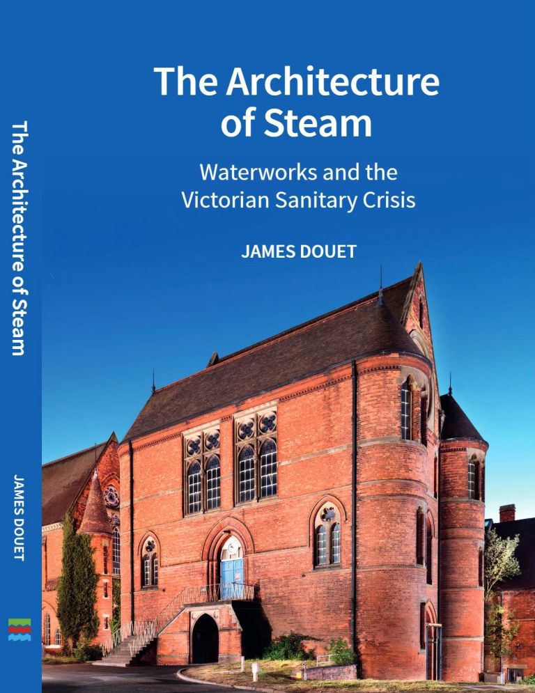
James’ book was awarded the Association for Industrial Archaeology’s prize for outstanding scholarship in 2024, and shows how steam powered waterworks were the key technology which, in the 19th century, pulled industrial cities back from the disease and filth that threatened urban life. There is no better place to see this architecture and technology than at the London Museum of Water and Steam. The volume places the London pumping stations, and especially the Kew Bridge waterworks, at the forefront of this global technological advance. The illustrated talk connects steam engineering, Victorian architecture and the day-to-day operation of a pumping station in a vivid narrative, and explains why Kew Bridge and Kempton Park should together be considered for UNESCO’s World Heritage list as the world’s outstanding sites of the water industry.
James Douet worked for English Heritage preparing listing recommendations before moving to live in Barcelona in 1996. He is involved with both TICCIH and ICOMOS, and assessed the successful World Heritage bid of Augsburg Water Management System. His other publications include ‘Going Up in Smoke’ for SAVE Britain’s Heritage (a study of industrial chimneys), and in 2025 ‘The Meaningful City, Reading Barcelona’s Urban Landscape’.
Talk tickets are £3 for members, and £5 for non-members. Add a copy of the James Douet’s 2024 book ‘The Architecture of Steam’ to your order and tye London Museum of Water & Steam will have it ready for you to collect on the day of the talk.
To book, follow this link: Event Page- Author Talk – London Museum of Water and Steam